

ANNA MARIA – City resident and Anna Maria Island Sail & Power Squadron member David Haddox helped the city determine which buoys and waterway markers remain in place, which markers are missing as result of Hurricanes Helene and Milton and who is responsible for replacing them.
Haddox chairs the city’s Planning and Zoning Board, is the Past Commander of Anna Maria Island Sail & Power Squadron and currently serves as Rear Commander for America’s Boating Club | United States Power Squadrons.
When presenting his findings to the Anna Maria City Commission on April 10, Haddox said, “The mayor asked me, based on my power squadron experience, to assist him with a program to try to identify waterway markers surrounding the city of Anna Maria that are missing or off-station.”
He used the Florida Fish and Wildlife Conservation Commission’s (FWC) interactive online Uniform Waterway Marker Map to identify the locations of the buoys and waterway markers on record with the state agency. Clicking on the icon for each waterway marker identifies its permitted latitude and longitude, the message displayed on the marker, the permit number and more.
The Manatee County Sheriff’s Office Marine Unit, Haddox, AMI Sail & Power Squadron member Jay Winters and the city’s general manager, Dean Jones, went out by boat and visually identified the remaining and missing markers.
They also identified some markers not shown on the FWC map, including markers in Bimini Bay that mark the channel for safe navigation in and out of Anna Maria’s residential canals and five nautical dayboard markers at the entrance to Bimini Bay permitted to the West Coast Inland Navigation District (WCIND). The WCIND markers remain in place but a couple are damaged. According to Haddox, there were no markers in Lake La Vista before the hurricanes hit.
Using PowerPoint and the FWC map, Haddox created a map that indicates which waterway markers remain and which are missing; all but two of the 21 markers that should surround the city of Anna Maria are missing. Using the permit numbers listed on the FWC map, Haddox contacted the FWC and the U.S. Coast Guard to identify the permit holder for each marker in the “string of pearls” that is supposed to surround the city.
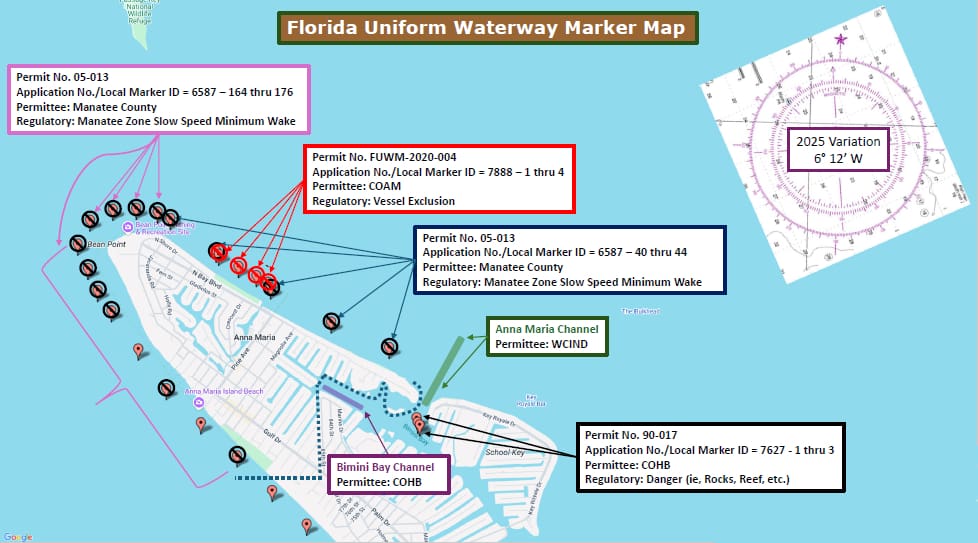
The missing markers include four vessel exclusion markers permitted to the city and previously located offshore of Bayfront Park. As the permit holder, the city is responsible for replacing those markers, which prohibit motorized vessels from entering that offshore area often used by swimmers.
“It is a crime to bring a vessel between those markers and shore because we don’t want people and propellors in the same water at the same time,” Haddox said. “The sheriff’s office will be enforcing that once we get those markers put back.”
Haddox said a portion of the vessel exclusion zone created by the initial positioning of the four waterway markers overlaps the channel leading in and out of Lake La Vista. This resulted in boaters inadvertently and unknowingly passing through the vessel exclusion zone. According to Haddox, FWC approved repositioning the replacement markers in a manner that will remedy this concern.
one of the missing vessel exclusion markers was discovered in the channel that connects to Lake La Vista and will be correctly repositioned outside the channel.
Most of the other markers displayed on the FWC map list Manatee County as the permit holder and Haddox said the city would notify the county about the missing markers the county is responsible for replacing. Haddox also contacted Holmes Beach Police Chief Bill Tokajer and the Holmes Beach city planner regarding some missing markers in that city’s waters.
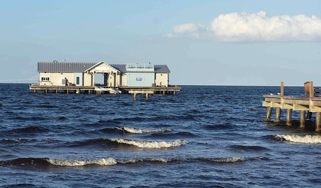
Pier debris
At Mayor Mark Short’s request, Haddox also helped the city obtain FWC approval to temporarily place four “Danger” waterway markers on each side of missing City Pier walkway, where concrete pilings and other debris is submerged or partially submerged where the pier walkway previously stood.
Haddox said unlike the legally enforceable vessel exclusion zones, the “Danger” signs placed near the pier will be informational only and not subject to sheriff’s office enforcement.
“They might see someone doing it and suggest that’s a bad idea, but the vessel exclusion you can actually get a ticket for,” Haddox said.
Short said, “I want to thank you and the power squadron for stepping in and helping us with this project. I don’t think we have anybody on staff that even remotely would qualify to do what you guys do and we really appreciate it.”
Short asked Haddox to share some information he obtained on the city’s behalf regarding a WCIND grant program for placing or replacing waterway markers.
“We are applying for reimbursement. The grant, if it’s awarded, will be awarded on Oct. 1, Haddox said. It’s entirely likely this entire project will be paid for WCIND and not cost the city a thing.”