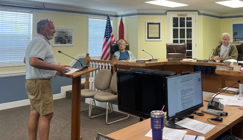
BRADENTON BEACH – No rental moratorium is in place in Anna Maria Island’s southernmost city.
Prior to the adoption of a resolution Thursday requiring residents and business owners to have structural and electrical inspections before occupancy is permitted, Bradenton Beach commissioners discussed and rejected a moratorium on rental properties in the city.
“The city of Holmes Beach is in a position where they’ve decided to look at it from the perspective of a moratorium for certain classifications of individuals who are coming to stay in the city,” City Attorney Ricinda Perry said.
The city of Holmes Beach issued a 45-day moratorium on rentals on Oct. 2. Holmes Beach is the only one of the three Island cities to enact such restrictions.
“A moratorium shuts everything down. There is nothing you can do even if you’re up and running and you’ve invested say, you’ve personally spent $5,000 with an inspector, you’ve spent $20,000 on Servpro getting it cleaned out and now you’re ready to go, it doesn’t matter. You couldn’t rent it until that moratorium is lifted,” Perry said.
Perry explained that a moratorium is an ordinance, while a resolution is a policy that can be put into effect immediately.
“This one is a lot more flexible. It lets you work within the timeframe that works for you as a property owner, and to me, it accomplishes the same goal – public health, safety and welfare – to make sure the structures are safe,” she said. “This does that but it puts it on your timeline as a property owner as opposed to the government’s timeline.”
Commissioner Debbie Scaccianoce expressed concerns about an influx of renters straining the city’s infrastructure and resources during the recovery process.
“Our roads aren’t really even up to par, but because people can afford to have all these inspections and we’re greenlighting them, now we’re having all this extra vehicle traffic and people to areas of our city that maybe aren’t really ready otherwise. I get it, we want to return to normal, but what about health and safety in a more general sense?” she asked.
Perry responded that if Police Chief John Cosby feels it is unsafe to have renters come in he will make that known.
“I am of the legal opinion that the state statute has pre-empted our ability to classify renters from a one-month resident to a one-year resident to a full-time resident. I don’t feel legally comfortable drawing a distinction on who is going to use the structure,” Perry said. “If that is something you really want to explore then I’m going to need to find some justification on the public safety and welfare threat as a whole when I don’t even have data on how many rentals will be up and running.”
Perry said that code enforcement can determine whether or not a property that is being occupied has gone through the inspection process.
“If not, then we can initiate the process to shut them down,” she said.
“So, if they go through the process right away and they’re good to go, they can rent?” Commissioner Ralph Cole asked.
“Correct. I do not feel comfortable having the distinction legally about who is in the structure,” Perry said. “What the statute says about treating residents differently from rentals, the statute does not tolerate that. I am uncomfortable segregating that classification. If it’s a building and a person in the building, I don’t care if they’re here for a week, I don’t care if they’re here for a month, I don’t care if they’re here for a year, the statute says that I have to look at it that way and that is my recommendation to not segregate and classify.”
Perry said a resolution can be easily modified.
“The nice thing about a resolution with this is we could come back at an emergency meeting and have a new resolution that tamps it down,” she said. “You can turn on a dime; I prefer to be as flexible as we can and see where we are on a week-by-week basis.”
Perry said retired city building official Steve Gilbert will assist current Building Official Darin Cushing.
“Steve Gilbert has been reaching out and gotten some people who will come down with him and work with Darin,” she said. “He loves our community; he was with us for 16 years. The suggestion he had was a little different from Holmes Beach’s approach, and it’s an approach that I really like and that Darin really likes.”
A resolution was passed unanimously by the city commission requiring structural and electrical inspections before occupancy to be done on homeowners’ timelines. It consists of the following three components:
No occupancy will be permitted in any structure until the following conditions are met:
Structural inspection: Any structure built after Dec. 31, 2002, shall be inspected by a Florida-licensed general contractor to determine if it is safe to occupy; and any structure built prior to Dec. 31, 2002, shall be inspected by a Florida-licensed engineer to determine if it is safe to occupy.
Electrical inspection: All structures shall be inspected by a licensed electrician to determine if they are safe to occupy.
In the event alternative inspections are needed, or alternative procedures for safety are needed, then the building official may in his determination provide an alternative process to determine if a structure is safe.
City permitting fees will be waived, and Cushing has the ability to issue emergency hand-written permits.
BRADENTON BEACH – Planning and Zoning Board members have rejected a rezoning ordinance that would change some residential properties to mixed-use, asking that it be rewritten to reflect the board’s previous consensus to rezone to two-family residential (R-2).
The ordinance that Building Official Steve Gilbert and City Planner Luis Serna presented on June 15 proposed rezoning more than 20 properties from Highland Avenue to Gulf Drive and from Second Street North to Cortez Road. The properties are zoned R-3 (multi-family residential) and city staff recommends rezoning them to mixed-use (MXD).
Building Official Steve Gilbert and City Planner Luis Serna hope to make the city’s zoning and future land use maps consistent with each other. – Joe Hendricks | Sun
The building department is requesting the rezoning to create better consistency between the city’s zoning maps and the future land use maps contained in the city’s comprehensive plan. Gilbert stated previously that the existing map inconsistencies could potentially create legal issues for the city.
The current R-3 zoning designation allows for up to 18 residential units per acre, but those same properties also carry the ROR (residential/office/retail) future land use map (FLUM) designation implemented when the city’s comprehensive plan was amended in 2008. The zoning map was never amended to bring it into agreement with the amended future land use map.
According to Gilbert, the ROR FLUM designation allows for a small store or retail operation, a takeout restaurant or an attorney’s office on the ground level with residential units above. The current R-3 zoning designation does not allow for those commercial uses. Gilbert and Serna recommend maintaining the existing ROR FLUM designation and rezoning those properties to mixed-use consistent with the FLUM designation.
The properties highlighted in orange on the city’s zoning map currently carry a R-3 zoning designation. – City of Bradenton Beach – SubmittedThe properties highlighted in light purple on the city’s future land use map currently carry a Retail/Office/Residential designation. – City of Bradenton Beach | Submitted
During preliminary discussions in May 2021, the board recommended rezoning those properties to R-2 (two-family residential) with an amended medium-density FLUM designation.
The R-2 zoning designation allows one-family dwelling units, two-family dwelling units (duplexes), group homes, foster care facilities with less than five residents, family day care homes and private parks that include playgrounds and preservation and conservation uses. The R-3 designation allows one-family dwelling units, two-family dwelling units, multi-family dwelling units, group homes, foster care facilities and family day care homes.
“The mixed-use would allow for in- creased lot coverage and increased total impervious surface coverage. Mixed-use provides for residential over retail, so this would give the opportunity to put small shops on the ground,” Gilbert told the board.
Board members John Burns, Ken Mc Donough, Fred Bartizal and Dan Morhaus expressed their collective desire that the ordinance eventually presented to the city commission for adoption, modification or rejection should reflect the board’s 2021 consensus.
Serna cautioned that downzoning those properties from R-3 to R-2 could expose the city to future legal challenges – including Bert Harris claims seeking compensation for the loss of the development rights currently granted by the R-3 zoning.
Ordinance opposition
Burns adamantly expressed his oppostion to Ordinance 22-541 as presented during Wednesday’s meeting and he questioned why it didn’t reflect the board’s 2021 consensus.
“What I don’t understand is that we had a consensus. We had a clear recommendation. What I would be looking for is an ordinance that implements that consensus recommendation,” Burns said.
Regarding the proposed mixed-use zoning designation, Burns said, “The MXD zoning district has allowances for a couple other things. Instead of 35% lot coverage, it goes to 70% – twice the lot coverage. Any time you increase the lot coverage you decrease the spacing between the structures and that affects the general appearance of the area; and it can or cannot affect property values, as can placing a ROR bottom story retail/office down- stairs. Seventy percent lot coverage changes the character of the area as well. It’s expansion of, essentially, a commercial district. In addition, the maximum lot coverage plus impervious (surface) goes from 40% to 85%, which decreases the greenspace and affects the entire area in a different fashion.”
In defense of the ordinance language presented that day, Gilbert said city staff was originally charged with bringing the city’s zoning designations into agreement with the city’s existing FLUM designations, and the ordinance presented reflected that city commission directive.
Public input
A handful of potentially impacted residents and property owners attended Wednesday’s meeting. During public input, homeowner Herman Fernandez expressed concerns that mixed-use zoning would create additional parking issues and lead to the commercialization of those residential areas. He said staff’s proposed rezoning would not be a positive move for the permanent residents living in those areas.
Resident Herman Fernandez is concerned about the proposed mixed-use rezoning. – Joe Hendricks | Sun
“What is our goal here? I know things change as time goes on, but I’m not sure this is a good move,” Fernandez said.
Property owner Evelyn Stob said she likes the board’s proposed R-2 zoning designation better than city staff’s proposed mixed-use zoning designation.
Fernandez’s neighbor, Mark Heller, said he doesn’t want bars and restaurants being located in areas currently zoned for residential uses.
Gilbert said he doesn’t think the commission’s intent in 2008, before his arrival, was to allow for more bars and restaurants, but to allow for ground-level retail operations with residential units above.
In response to the board’s request for a revised ordinance, Gilbert said he’s not comfortable rewriting the ordinance without first discussing it with the city attorney. He also said changing the current FLUM designation from ROR to medium density residential would require a second and separate ordinance.
BRADENTON BEACH – The Bradenton Beach Planning and Zoning Board (P&Z) has completed its preliminary review of several proposed future land use and/or zoning map revisions.
The revisions could potentially increase or decrease the value of specific properties depending on whether they increase, maintain or decrease the current allowed uses for those specific properties.
Requested and suggested by Building Official Steve Gilbert and City Planner Luis Serna, the map revision process is being undertaken to correct numerous map inconsistencies that exist throughout the city.
The P&Z review and recommendation process took place during four recent P&Z meetings, the last of which was on Wednesday, June 16. The staff- and P&Z-recommended map revisions will be compiled and formatted for future presentation to the city commission members, who will ultimately make all final decisions regarding any map revisions.
Potentially impacted property owners will be notified before any public hearings are scheduled and any final map revision decisions are made. The yet-to-be-scheduled public hearings will allow property owners and others to address P&Z members and city commission members before any proposed map revisions are finalized.
Recommended revisions
On June 16, the P&Z members supported the staff’s recommendation to create a new C-3 (Water Dependent Commercial) zoning designation and apply that designation to the Bradenton Beach Marina property. This proposed action would make the zoning designation consistent with the newly-created Water Dependent Commercial future land use designation.
Board member Fred Bartizal asked if marina owner Mike Bazzy is aware of the proposed zoning designation. Gilbert said he was, and he may have some concerns to share with the city commission at a later date.
City staff and P&Z members recommend the city-owned parking lot next to the Public Works Department building be rezoned from R-3 (Multi-Family Dwelling) to Public/Semi-Public.
A zoning change had been recommended for these residential properties along Bay Drive North. – Joe Hendricks | Sun
The P&Z members recommend rezoning the waterfront residential properties along the east side of Bay Drive North, between Second Street North and the marina, from R-3 to R-2 (Two-Family Dwelling), and to change the future land use designation to medium density. The stretch of residential properties includes two large vacation rental homes currently being built at the south end of the street.
Staff and the P&Z members recommend rezoning several residential structures along Gulf Drive South, between Fourth Street South and Bridge Street, from the existing C-2 (General Commercial) to R-3 (Multi-Family Dwelling), with a high-density residential future land use designation.
Those potentially-impacted properties include a four-unit vacation rental structure owned by Wendy and George Kokolis, John Metz’s beachfront home – half of which is used as a vacation rental, the Linger Longer resort formerly owned by the late Bradenton Beach Mayor Bill Shearon, Capris Condos and The Sandcastle Beach Resort.
Gilbert said that despite the current commercial zoning designation, all of those properties have been used for residential purposes for many years now, including those used as vacation rentals or resorts. There are currently no commercial operations such as retail shops or restaurants along that side of the street on that stretch of Gulf Drive South.
The elimination of an existing zoning designation would not impact Old Bridge Village condominium owners. – Joe Hendricks | Sun
Staff and the P&Z members recommend removing any existing zoning and future land use designations from the city-owned rights of way between the eastern edge of Bay Drive South and Sarasota Bay. Gilbert said no other city streets or rights of way within the city have zoning or future land use designations.
Gilbert said removing the existing E-1 (Preservation) zoning designation from that stretch of land and/or submerged land between Third and Fifth streets south would not impact the property privately deeded to the Old Bridge Village condominiums. He also said it would not impact the continued use of any existing docks along Bay Drive South, or the future construction of new docks in that area.
The recommended map revisions will now be summarized in a new document to be presented to the city commission and the public for preliminary review before any public hearings are scheduled.
BRADENTON BEACH – The Anna Maria Island Moose Lodge #2188 has a new kitchen that’s open for business for members and guests.
Located in Bradenton Beach, the Moose Lodge’s new kitchen features a 6-foot indoor grill, four convection ovens, a large flat-top grill, a new fryer, a 10-burner gas range, a broiler and a new concrete floor that replaced the old wooden floor.
The new kitchen opened on Wednesday, May 12, and business has been brisk.
“It’s been non-stop,” chef and kitchen manager Zack Machleit said.
“It’s definitely a state-of-the-art kitchen. We doubled the size of the grill and the flat-top, added a 105-pound. fryer and doubled the convection ovens. We can serve twice the amount of people in half the time,” he noted.
The new Moose Lodge kitchen features a new, larger fryer. – Joe Hendricks | Sun
While the renovations took place, Machleit and his kitchen crew often worked outside in a makeshift grilling area that offered a limited menu.
“That was the longest 15 months of my life,” Machleit said of the renovation process and the wait for the new kitchen to open.
Lodge Administrator Byron Dalton is also pleased to have the kitchen open again.
“We have had the kitchen open for two weeks now and the response has been absolutely phenomenal. We have much more cooking space and the ability to feed people faster. It’s made it easier on our men who work in the kitchen. We have an upgraded menu and our members are happy,” Dalton said. “It’s a boost to the Moose economy. We’ve got our waitresses working again, the bartenders are busy and people are coming back again. It’s amazing what a new kitchen can do.”
The kitchen renovations coincided with the Moose shutting down in early 2020 as a result of the COVID-19 pandemic. Dalton said the plan was to tear the old kitchen apart and have a new kitchen ready to go when the lodge reopened, but the project encountered some unanticipated delays along the way.
“A special thanks to WMFR Fire Marshall Rodney Kwiatkowski and Bradenton Beach Building Official Steve Gilbert. They were great to work with and they made suggestions that helped us get this done right,” Dalton said.
In addition to the regular menu, the Moose Lodge #2188 kitchen also offers daily specials that include Reuben sandwiches on Monday, pizza on Wednesday and a prime rib dinner on Friday. Plans are also in the works for a Sunday brunch that’s expected to start in early June.
The AMI Moose Lodge kitchen is open from noon until 8 p.m. daily, and the lodge is open from 11 a.m. until 9 p.m. daily. You can view the upgraded AMI Moose Lodge menu at the lodge’s new website.
UPDATED May 5, 2021 at 3:15 P.M. – BRADENTON BEACH – The city’s ongoing efforts to resolve inconsistencies between its future land use and zoning maps could potentially impact property values and the future use of many properties citywide.
The inconsistencies were created when the city adopted a revised future land use map as part of its 2020 comprehensive plan. Building Official Steve Gilbert and City Planner Luis Serna are now guiding the Planning and Zoning Board (P&Z) and the city commission through the early stages of the map revision process. The goal is to make the zoning and future land use maps consistent with each other.
The map revisions being considered are not intended to alter the current use of an impacted property but could become a significant issue if the property is sold, demolished by a storm, or redeveloped in a manner that differs from its current use, possibly impacting the property value.
During the April 21 P&Z meeting, the future land use and zoning maps for the Sandpiper Resort Co-Op were discussed in depth. The future land use and zoning map designations for several properties in the 2200 and 2500 blocks of Gulf Drive North were also discussed in depth.
Sharky’s Seagrill, the Shell gas pumps and the Circle K properties are among those that could be impacted by the proposed map revisions. – Joe Hendricks | Sun
The potentially impacted properties in the 2500 block of Gulf Drive North include Sharky’s Seagrill, the Shell gas pumps and Circle K convenience store, a vacant lot, Club Bamboo and the two-story structure occupied on the ground level by the Studio 104 salon, the KW on the Water real estate office and the Blooms by the Beach florist shop, with residential units located above. Similar map inconsistencies exist in the 2200 block of Gulf Drive that could potentially impact the Aluna Wellness Center & Spa and Wagner Real Estate properties.
Several other potentially impacted properties throughout the city have not yet been discussed by the P&Z board. The additional maps of these potentially impacted areas and properties can be viewed here. The board’s map revision discussions will continue on Wednesday, May 5 at 11 a.m., with the issue also expected to be discussed at the Wednesday, May 19 P&Z meeting.
The zoning and future land use designations for Sandpiper Resort property (at the top of this map) and the properties located in areas marked as #4 were discussed at the April 21 meeting. City of Bradenton Beach | Submitted
During the April 21 meeting, Gilbert said the purpose of that day’s meeting was for the P&Z members to review the proposed map revisions and make their recommendations to the city commission. The city commission has the sole authority to make any final decisions regarding map revisions.
“This is not a public hearing to formally adopt these maps,” Gilbert noted.
Sandpiper Resort
In 2008, the city commission amended the future land use map, decreasing the maximum units allowed on the majority of the Sandpiper property from 18 units per acre to nine. But the coinciding zoning map that establishes the M-1 (mobile home park) zoning district was not revised in 2008 and has not been revised since then. The number of lots allowed by the land development code on the Sandpiper property exceeds the density established by the current future land use map.
According to the future land use map, the majority of the Sandpiper property carries a medium-density residential land use designation. The portion of the property closest to the Anna Maria Sound shoreline carries a low-density residential land use designation.
Gilbert and Serna recommend amending the future land use map designation to high-density residential, which would return the Sandpiper’s future land use designation to its pre-2008 status.
P&Z member John Burns opposed that action and instead proposed revising the zoning map to match the nine units per acre allowed by the future land use map.
Planning and Zoning Board member John Burns does not support increasing density allowances to correct existing map inconsistencies. – Joe Hendricks | Sun
The board members expressed concerns that revising the zoning map to allow 18 units per acre could result in a more intense future use of the Sandpiper Resort property should it ever be redeveloped as something other than a mobile home park. Burns said reversing the 2008 future land use map amendment would double the allowed density.
In response, Serna said, “The intent is to reflect what’s on the ground there currently. This was a change that occurred in 2008, which is basically making those properties non-conforming. They conform to the zoning, but the zoning does not conform to the future land use. We’re really just trying to give them back what they had prior to 2008.”
Burns said he was not aware of any Sandpiper Resort property owners who objected to the 2008 future land use map revision.
City Planner Luis Serna cautioned against making any revisions that devalue property values. – Joe Hendricks | Sun
“I’m not sure what the public response was back then, but it is definitely something where the city is out of compliance with its own plan. That’s a concern,” Serna said.
Gilbert said the Sandpiper property has historically been zoned M-1, under the high-density residential criteria, and changing that zoning would have consequences.
“We would be taking away dwelling unit density from them. Which is why we’re recommending making this (the future land use map) consistent with the historic use and the current use rather than rezoning it and potentially causing damage to their property value by changing future land use back to what it was before this map was done,” Gilbert said.
Board member Bill Morrow asked if the Sandpiper Resort community is currently configured to nine units per acre. Gilbert said the current density is much higher than that.
“There are two choices to be made here: one is to revert back to high density for that entire parcel and a future developer could fit quite a few units in there. If you keep it the way it is, future developers are not going to be able to pack as many buildings or dwelling units in there. The second option is to change it (the future land use designation) back so that the mobile home park remains conforming to current zoning, but that also gives them the ability, if they choose to sell the property, to develop the property at 18 units per acre,” Gilbert said.
“I see no benefit to the city nor to adjacent properties in changing it back to the way it was,” Burns said.
The board voted 5-0 in support of Burns’ motion to recommend the city commission amend the zoning map to match the nine units per acre currently allowed by the future land use map, despite the recommendations of Gilbert and Serna.
Gulf Drive North
The board also discussed the map inconsistencies that exist in the 2500 and 2200 blocks of Gulf Drive North.
The future land use map currently designates those areas as R-2 medium density residential with a C-2 general commercial zoning designation.
“All the uses on the property are commercial,” Serna said of the existing property uses.
Serna and Gilbert recommended amending those future land use map designations to Retail/Office/Residential (ROR) in order to be consistent with the existing zoning and current uses of those properties.
Burns expressed concerns that commercially zoned property with an ROR future land use designation would allow new structures to be built with 90% lot coverage.
“You might have 90% lot coverage when you get done with the parking lot, but building coverage, no,” Gilbert responded.
Board member Fred Bartizal said he likes the existing zoning the way it is.
“Why change it?” Burns asked.
“Because the uses of the property are not residential,” Serna replied.
Serna said the Circle K property is zoned C-2 but the future land use designation is medium density residential.
“That’s where the inconsistency is,” he noted.
Burns asked if a new Circle K building could be built on that property if a storm or some other disaster destroyed the existing structure.
In response, Gilbert said, “Not really, because C-2 zoning is not consistent with the medium density dwelling as established by the future land use map. The future land use map says zero to nine dwelling units per acre and no commercial development is to occur there. It’s a residential land use. Your commercial zoning is not consistent with your comprehensive plan and the existing uses there would become non-conforming uses. In order to make them conforming, you either change the future land use map or you change the zoning. To preserve the character of what’s up there now, the future land use map goes to ROR and the zoning goes to mixed-use, rather than commercial.”
Building Official Steve Gilbert explained the map revision options and potential consequences. – Joe Hendricks | Sun
“The comp plan is saying that should be residential and what’s on the ground isn’t residential. That’s all we’re trying to fix,” Serna said.
“You’re opening a can of worms to fix it,” Burns replied.
Serna said not allowing commercial structures in those areas could subject the city to legal challenges.
“They could sue the city and that’s the concern we’re trying to address. We don’t want to take away anyone’s rights through down-zoning,” Serna said.
Regarding properties made non-conforming with city code due to past or future commission actions, Serna said, “They can exist as long as they’re not destroyed, but the owners of those properties could rightly come and say we’ve had a development right under zoning and now it’s being taken away.”
Board member Fred Bartizal expressed concerns about making zoning revisions that could potentially allow for more intense development.
“What worries me is there’s some pretty smart developers out there right now with some real smart lawyers. If we change any of them, will it make it easier for them?” he said.
Board chair Ken McDonough noted the challenge for the city is what happens if a property owner wants to develop a property where there are inconsistencies between the zoning and future land use maps.
“What do you do? Do you go by the zone map? Do you go by the future land use map?” he asked.
“That’s why we’re having this discussion,” Gilbert said. “There’s a vacant lot next to the Circle K. It’s zoned C-2. The land use is duplex and they want to put in shopping. If we follow the zoning it will become a duplex.”
The board unanimously supported Burns’ motion to recommend the city commission change the zoning map to match the current future land use map, which is medium density residential, R-2 – which allows single-family residences or multi-family duplexes and apartments, despite what Gilbert and Serna recommended.
Gilbert noted that before any final map revision decisions are made by the city commission, all potentially impacted property owners will be notified and will have the opportunity to address the P&Z board and the city commission when future public hearings are held.
BRADENTON BEACH – City Building Official Steve Gilbert has the city commission’s support to issue a stop work order on a county drainage project that would remove at least 103 and possibly up to 232 Australian pines from Coquina Beach.
This comes in response to the Manatee County Commission’s 4-2 decision on Tuesday, June 18 to remove 97 more Australian pines from the south end of the Coquina Beach parking lot as part of the county’s drainage and paving project. Six pines already were removed earlier this month.
“I think they knew they were going to have to take trees out, they just didn’t divulge it. They didn’t tell us there might be an impact to the trees.” – Steve Gilbert, Bradenton Beach building official
“This would not be ‘Stop, halt, desist and take everything out.’ It would be ‘Take a break and let’s talk about this,’ ” Gilbert told the commission on Thursday, June 20.
Gilbert, City Attorney Ricinda Perry and the commission agreed to first extend the courtesy of putting the county on notice before issuing a stop work order that would bring the county project to a temporary halt.
The city’s land development code prohibits planting Australian pines and other non-native nuisance species, but the code requires replacing each prohibited tree removed with an allowed species on a one-to-one basis. City code also requires the replacement trees to be at least five feet tall.
Memo issued
On Friday, Gilbert sent a memo to Manatee County Project Manager Michael Sturm.
“The city is hereby placing the applicant on notice that Manatee County must come into compliance with this Land Development Code. Please prepare and submit a plan showing the location of all trees to be removed in the project area, along with a signed/sealed landscaping plan to show the locations of the replacement trees, including a list of the tree species proposed. We will then amend the project application to include the landscaping plan,” Gilbert’s memo said.
“Please be advised that the Land Development Code authorizes the city of Bradenton Beach to stop work on a project when situations such as this arise, until sufficient information is provided to assure compliance with the code. Rather than take this action, my office would prefer that we collaborate on a solution. We ask that you take steps to prevent the removal of any trees until this matter is fully resolved. This is a matter of importance, and time is of the essence. We would like to meet with you as soon as possible to review the situation and the requirements,” Gilbert’s memo concludes.
“If you’re taking out 240 trees you will replace them with 240 trees,” Gilbert told the Sun earlier in the week.
He said county officials never mentioned tree removals when seeking the city-issued approvals and permits.
“I think they knew they were going to have to take trees out, they just didn’t divulge it. They didn’t tell us there might be an impact to the trees,” Gilbert said.
City permitting
The county-owned beach is within the city limits and the county project requires city approvals and permitting.
On March 1, 2018, the city commission unanimously approved the project’s proposed lot coverage that County Engineer Sia Mollanazar said would include 47,437 square yards of pervious concrete and 1,098 square yards of impervious pavement.
On June 13, 2018, Sturm sent City Engineer Lynn Burnett an email that said he and Mollanazar would appreciate the city waiving its permit fees.
The agenda item request that Burnett submitted for the June 21, 2018 commission meeting said the estimated permitting fees would exceed $100,000 and delay the project. The commission unanimously approved the county’s request, except for some minimal administrative costs.
During his two appearances in Bradenton Beach, Mollanazar never mentioned tree removals.
On April 10 of this year, Gilbert issued the county a zoning and land use permit that noted the county paid only $500 of the $48,190 that could have been charged in permitting fees, saving the county $47,690.
Commission discussion
During last week’s meeting, Mayor John Chappie said he talked to Manatee County Commission Chair Steve Jonsson. Chappie suggested the county money would be better spent addressing stormwater issues slightly to the north at Cortez Beach, where Gulf Drive and the adjacent bike lane are frequently flooded.
Vice Mayor Jake Spooner said the county project could have been designed with less impact on the trees had the county obtained a stormwater permit. Instead, county staff chose to place the drainage and paving improvements in the existing footprint of the parking areas and access roads. This alleviated the need for a state-issued stormwater permit.
Commissioners Randy White and Jake Spooner question the county’s proposed tree removal plans. – Joe Hendricks | Sun
Spooner questioned the wisdom of completing the project’s first phase when there is now some doubt as to whether county commissioners will approve the project’s proposed second phase.
“The majority of the parking’s still going to be flooded down at the other end,” Spooner said of that potential scenario. “There’s a lot I don’t understand about this.”
Commissioner Ralph Cole said he supports the county efforts to discharge cleaner stormwater into the nearby natural waterways, but he said removing that many trees could negatively impact air quality.
Chappie and Commissioner Randy White said they didn’t recall hearing anything about tree removals when the county project was proposed to the commission.
Mayor John Chappie wishes the county would consider trimming and saving as many Australian pines as possible at Coquina Beach. – Joe Hendricks | Sun
When contacted earlier in the week, Chappie and Spooner both said they were very disappointed by the county commission’s decision, but they thanked commissioners Betsy Benac and Carol Whitmore for opposing the project as currently planned.
“I had hoped that at the very least the county would have considered the option of cutting down 50 trees and trimming the others,” Chappie said.
Privacy choicesWe use Google Analytics to understand readership and improve the website. Analytics cookies are optional and can be accepted or declined.Privacy Policy